Skip to Content

Baruch Institute

Real-time Data

Two scientists in a creek at low tide with research equipment

Water Levels

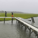
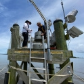
The North Inlet-Winyah Bay (NIWB) NERR tracks and reports tide heights in near-real time at the Oyster Landing research pier using a Hohonu ultrasonic sensor. 

NOAA provides tidal predictions for locations within the North Inlet estuary, including Oyster Landing (Station ID: 8662245) and Clambank Creek Dock (Station ID: 8662299).

Two scientists on research pier in rain

Weather

The NIWB NERR meterological station at Oyster Landing pier collects near-continuous weather data as part of the NERR System-wide Monitoring Program (SWMP).

Data are available from the NERR Centralized Data Management Office's (CDMO) Real Time Application (Station ID: NIWOLMET)

Thumbnail image of Winyah Bay SWMP monitoring station

Water Quality

The NERR's SWMP program collects water quality data (including temperature, salinity and dissolved oxygen) at 15 minute intervals from six locations within North Inlet and Winyah Bay.

Data are available via the NERR CDMO's Real Time Application for three of the six sites:
- Oyster Landing (Station ID: NIWOLWQ), 
- Winyah Bay Surface (Station ID: NIWWSWQ) 
- Winyah Bay Bottom (Station ID: NIWWBWQ).

Thumbnail image of webcam view screenshot.

Webcams

Multiple cameras around the Baruch Institute facilities offer live views of North Inlet estuary's salt marshes, oyster reefs, creeks, and critters (researchers included, of course).


Challenge the conventional. Create the exceptional. No Limits.

©